South Chios · Mastic villages
History & architecture
Kalamoti
A living medieval village, where stone lanes and quiet squares open onto the fertile landscape of southern Chios.
Discover this place ↗Follow the stone lanes into Kalamoti’s past, then meet the village of today. Plan a walk, find a place to stay and explore southern Chios from here.
How did a medieval settlement become a centre of the mastic villages? Follow the fields, the schools and the people who built a shared future. Then explore what it could mean to make a home here.
Three invitations to look closer. Take the stops at your own pace, with room for a coffee and a conversation.
Suggested stops, not a marked trail. Old stone surfaces may be uneven; church interiors are not always open.
Look up at the arches, then notice how the houses join together. Let the public passages lead you towards Platsa.
Continue to the marble memorial beside the primary school. This is a separate stop from the village square.
For an optional extension, find Panagia Agrelopousaina southwest of the village. Confirm the approach and church access locally.
Follow the stone, the light and the details of the lanes. Open a photograph to see it without leaving the guide.
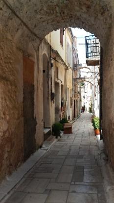
A passage frames the lane beyond. Notice the doorways, balconies and plants that share this narrow space.
S. Kossieris, O. Kourounioti, P. Agrafiotis & A. Georgopoulos · NTUA · CC BY 4.0
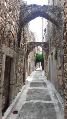
Look up as you walk: successive arches connect the stone fronts above the paving.
S. Kossieris, O. Kourounioti, P. Agrafiotis & A. Georgopoulos · NTUA · CC BY 4.0
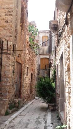
Doorways, exposed masonry and a small tree turn a passage into a place to look closer.
S. Kossieris, O. Kourounioti, P. Agrafiotis & A. Georgopoulos · NTUA · CC BY 4.0
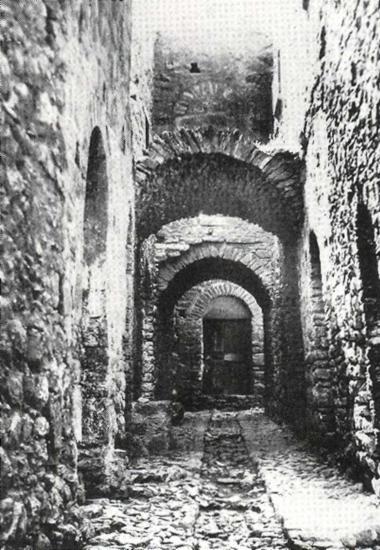
An archival view of the village’s arches. The Mingei catalogue dates its black-and-white photographs to 1930.
Mingei project / ICS-FORTH · via SearchCulture.gr · CC BY-SA 4.0
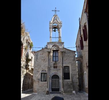
A stone church front rises between neighbouring buildings. The Mingei catalogue identifies the location as Kalamoti; it gives no capture date.
Mingei project · ICS-FORTH (photographer not named in catalogue) · CC BY-SA 4.0
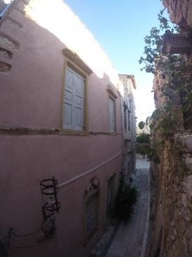
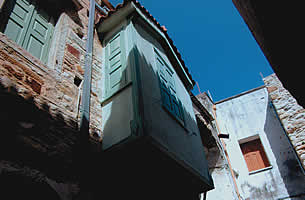
Shutters, coloured plaster and a glimpse of the sky. A raised camera view from the NTUA architectural survey, published in 2017.
S. Kossieris, O. Kourounioti, P. Agrafiotis & A. Georgopoulos · NTUA · CC BY 4.0
The lane photographs come from the NTUA team’s 2017 study. The church and historic arches are licensed previews from the Mingei collection on SearchCulture. Dates and sources are shown for each photograph.
One of the largest medieval mastic villages of Chios, Kalamoti invites you to look closely: at its stone houses, the shape of its lanes, and the layers of life that have changed it over time.
Kalamoti’s exact foundation date is uncertain. Local historical accounts describe an enclosure formed by the outer walls of houses and two entrances: Pano Porta to the east and Kato Porta to the west, with roads leading towards the square. They record four small corner towers that no longer survive and only a small southern remnant of the perimeter wall. Read these as descriptions of the historical system, not a promise of standing gates or an intact castle to visit today.
Read the source ↗From 1346, the Genoese Mahona company controlled the organisation and trade of Chios mastic, until the Ottoman conquest in 1566. Research by Nikolas Bakirtzis and Xenophon Moniaros places Kalamoti among the representative fortified mastic settlements. Their study links the villages with a wider network of storage places, ports, monasteries and fortifications. This context explains why architecture here concerns both protection and production: the village belonged to an economy connected to markets far beyond the island.
Read the source ↗The older houses formed a dense structure rather than isolated buildings. Arches supported spaces above streets, while upper courtyards brought light and air into the homes. Look for the relationship between passages, walls and doorways: it reveals how everyday life fitted into a limited, protected space.
Read the source ↗The archive describes arched lintels, carved stone frames and timber doors and shutters. Earlier combinations of brick and porous stone were followed by large alternating pieces of pale and red Thymiana stone, associated in the account with the influence of the mansions of Kampos. The façade therefore records choices and changes as well as defensive construction.
Windows widened towards the interior and could include built-in seats. Small stone projections outside supported boards for flowerpots. Projecting timber bays, called sachnista or kioski, are attributed by the archive to nineteenth-century craftsmen from Chios town. A single façade can hold several periods; its photograph alone cannot date each intervention.

A carved face and ornamental relief above an arch. The archive does not name the maker or building.
Αρχείο kalamoti.net.gr · Μαρία & Αργυρώ Κανάριου · Original album · Reproduced with permission
Agriculture and mastic remain part of Kalamoti’s identity. Local traditions include the detos dance and a representation of the Kalamotousikos wedding during Carnival. These are community customs rather than a daily visitor programme; check locally for current celebrations and join with respect for the people keeping them alive.
Read the source ↗Southwest of Kalamoti, Panagia Agrelopousaina offers a close encounter with Byzantine building craft. Its dedication is to the Dormition of the Virgin. Stone and reused marble fragments show how builders worked with materials from earlier monuments. The church is a place of worship as well as an architectural landmark.
Read the source ↗Kalamoti was also a meeting place in the modern history of mastic. The Mingei heritage research project records a general assembly of growers here in summer 1915, seeking protective measures for their product. In 1932, a committee again presented its findings at an assembly in Kalamoti. These episodes preceded the compulsory cooperative system established in 1938. They reveal a village involved in collective decisions about livelihoods, alongside the cultivation and cleaning carried out within families.
Read the source ↗Mastic cultivation is a cycle of work that extends beyond the summer harvest. Winter care, preparing the ground, making incisions and sorting the resin bring different generations into the same practice. UNESCO inscribed this know-how on its Representative List of Intangible Cultural Heritage in 2014. The recognition concerns living knowledge and community relationships. Understanding that distinction helps visitors appreciate Kalamoti’s surroundings as a working agricultural landscape, where skills are passed on through participation and mutual help.
Read the source ↗These are people’s homes. Keep doorways clear, ask before photographing residents and do not enter private courtyards. Wear comfortable shoes on the uneven stone. Church interiors may require prior arrangements.
Old photographs, winter music and a gift to local heritage. Public Facebook posts open a window onto village life.
Meet Kalamoti’s benefactors, discover what their gifts made possible, and find a thoughtful way to contribute today.
Start among the houses, or plan a separate outing into the surrounding landscape. Choose a few stops, read their stories and keep the ones that interest you.
Explore the churches, their history and photographs →
16 stops in and around Kalamoti
No stops match these choices. Clear a filter, or show all stops to find something to save.
South Chios · Mastic villagesA living medieval village, where stone lanes and quiet squares open onto the fertile landscape of southern Chios.
Discover this place ↗Kalamoti · Historic centreRead the village through its arches, stone façades and closely connected houses.
Discover this place ↗A small Byzantine church in the countryside southwest of Kalamoti.
Discover this place ↗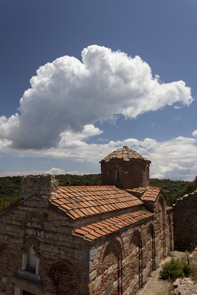 Outside Kalamoti · Near Exo Didyma
A Byzantine church on a rural hill, reached as a separate excursion from the village.
Discover this place ↗A marble memorial by sculptor Michail Tombros.
Discover this place ↗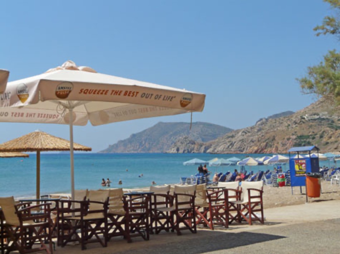 South Chios · Near Kalamoti
Long sandy shores, seaside cafés and an easy change of pace from the village lanes.
A quiet church stop within the village, best approached as part of a walk through the lanes.
Discover this place ↗Look upwards, then back into the lanes: a church stop that rewards a slower walk.
Discover this place ↗A starting point for understanding the village’s shared religious life.
Discover this place ↗A way to read the old centre through the space around Platsa.
Discover this place ↗A countryside option beyond the stone lanes, for a separate outing when conditions allow.
Discover this place ↗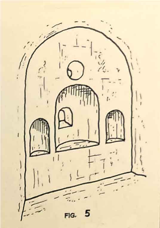 Kalamoti · Village
A village church seen through a surviving architectural drawing.
Discover this place ↗A church connected with the village’s July celebrations.
Discover this place ↗Find the distinction between Kalamoti’s two Panagia churches.
Discover this place ↗A family chapel between Kalamoti and Komi, with a documented story of care.
Discover this place ↗Pebbles, tamarisk shade and a quieter coastal stop beside Komi.
“Inside the village” describes location, not step-free access. Countryside and coastal stops are separate outings. Map searches need local confirmation; church opening and reservoir access are not guaranteed.
A walk you loved, a family memory, a photograph worth keeping. Send your experience to help others discover the village through your eyes.