On this page
YOUR WALKING COMPANION

Look closer

Directions open in Google Maps. Return to this tab for the next stop.

SELF-GUIDED WALKS · KALAMOTI

The village,
one step at a time.

Put the phone away between stops. There is plenty to notice above the lanes.

Five loops from 550 m to 4.4 km: village lanes, five village churches, a countryside chapel and neighbouring Patrika. Every walk begins and ends at Platsa.

Open the church-only guide →

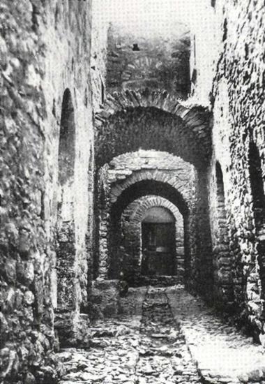
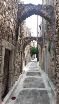
Successive stone arches above a paved lane in Kalamoti
Kalamoti’s lanes · a village view, not a route diagram. S. Kossieris, O. Kourounioti, P. Agrafiotis & A. Georgopoulos · NTUA · CC BY 4.0
CHOOSE BEFORE YOU SET OFF

A walk that fits your day.

Every loop starts and ends at Platsa. Compare time and terrain, preview the stops, then open your route on the map below.

A short first look

The little church loop

Distance
≈ 550 m
Time with pauses
30–45 minutes

Two churches and the village lanes, with the shortest return to Platsa.

Village paving · possible steps

Preview the stops · 2 sights + Platsa

START IN THE CENTRE · RETURN TO THE CENTRE

  1. 01Platsa · centre
  2. 02Saint Konstantinos
  3. 03Kato Panagia · Presentation of the Virgin
  4. ↺Back at Platsa

Select a stop to preview its story and the next leg. This shows the order, not a street map.

Village life & memory

The wider village loop

Distance
≈ 1.2 km
Time with pauses
50–70 minutes

Add the school and memorial to a circuit through the centre and its churches.

Village paving · possible steps

Preview the stops · 3 sights + Platsa

START IN THE CENTRE · RETURN TO THE CENTRE

  1. 01Platsa · centre
  2. 02School & memorial
  3. 03Saint Konstantinos
  4. 04Kato Panagia · Presentation of the Virgin
  5. ↺Back at Platsa

Select a stop to preview its story and the next leg. This shows the order, not a street map.

Five churches in one walk

Five churches · the village circuit

Distance
≈ 970 m
Time with pauses
60–90 minutes

Follow the five-church circuit. The guide describes exterior stops; interiors may be closed.

Village paving · possible steps

Preview the stops · 5 sights + Platsa

START IN THE CENTRE · RETURN TO THE CENTRE

  1. 01Platsa · centre
  2. 02Pano Panagia · Dormition
  3. 03Kato Panagia · Presentation of the Virgin
  4. 04Saint Konstantinos
  5. 05Agia Kyriaki
  6. 06Agia Paraskevi
  7. ↺Back at Platsa

Select a stop to preview its story and the next leg. This shows the order, not a street map.

Beyond the village lanes

The countryside chapel loop

Distance
≈ 3.3 km
Time with pauses
1½–2 hours

Continue into the countryside to Panagia Agrelopousaina, then return to the village.

Shared roads & rural tracks

Preview the stops · 3 sights + Platsa

START IN THE CENTRE · RETURN TO THE CENTRE

  1. 01Platsa · centre
  2. 02Kato Panagia · Presentation of the Virgin
  3. 03Panagia Agrelopousaina
  4. 04Saint Konstantinos
  5. ↺Back at Platsa

Select a stop to preview its story and the next leg. This shows the order, not a street map.

Two villages, one outing

Kalamoti & Patrika loop

Distance
≈ 4.4 km
Time with pauses
2–2½ hours

Make Patrika part of a longer outing from Kalamoti, using shared roads and rural tracks.

Shared roads & rural tracks

Preview the stops · 4 sights + Platsa

START IN THE CENTRE · RETURN TO THE CENTRE

  1. 01Platsa · centre
  2. 02School & memorial
  3. 03Patrika · village lanes
  4. 04Saint Konstantinos
  5. 05Kato Panagia · Presentation of the Virgin
  6. ↺Back at Platsa

Select a stop to preview its story and the next leg. This shows the order, not a street map.

Times are planning estimates, not a walking pace guarantee. Filters use the upper end of each time range. Uneven paving, steps and road traffic may affect your choice; these routes are not assessed for step-free access.

YOUR ROUTE, HERE IN THE GUIDE

See the whole circle.

Choose a loop and open walking view. Switch between Follow the route and Discover this stop to explore its history and people. Reading a story keeps your place in the walk; mark a visit only when you arrive.

Map + stops on one screen · manual progress, no live location

Loading the village map…

WALKING VIEW

Tap stops to navigate · no live GPS · stay on public lanes

Solid lines follow mapped streets; dotted links connect the reference pins to the nearest mapped road. This is an orientation map, not live GPS or turn-by-turn navigation. Offset number labels use a small line to their map point. Some entrances and short approaches need local confirmation.

© OpenStreetMap contributors · ODbL · Map data: 3 November 2026 · Map data · Route data

VILLAGE WALK 01

The wider village loop

Start at Platsa in the village centre. Take the northern approach to the school and memorial, continue south to Saint Konstantinos, then Kato Panagia, and close the loop at Platsa. Each sightseeing stop appears once; the centre is your start and finish.

≈ 1.2 km · Allow 50–70 minutes with pauses

Distance estimated by Google Maps on 3 November 2026. Suggested visit time includes pauses.
  1. Platsa café · meeting point

    Meet in the public space outside the café. Use its map pin as your starting reference, then look at how doorways and stone passages fit together around you. No purchase is needed to follow the walk.

    Discover this stop
    A VIEW OF LOCAL LIFE
    Inside the Platsa café, in a local account published in 2021; not an exterior arrival photograph⤢ Tap to enlarge
    Inside the Platsa café, in a local account published in 2021; not an exterior arrival photograph
    Photograph & sourceΜαστιχοχωρούσικα Νέα · Μιχάλης Κανάριος ↗

    Finding the stopBegin in the public space outside Platsa café. Confirm the café name and the map point before setting off; this indoor photograph cannot identify the entrance.

    A HISTORICAL SCENEA historical gathering at Monogyios’s café in Lower Platsa, identified in Michalis Kanarios’s 2021 account. This is a memory of café life, not today’s starting-point exterior.⤢ Tap to enlarge
    Café life in Lower Platsa

    A historical gathering at Monogyios’s café in Lower Platsa, identified in Michalis Kanarios’s 2021 account. This is a memory of café life, not today’s starting-point exterior.

    Photograph & sourceΜαστιχοχωρούσικα Νέα · Μιχάλης Κανάριος ↗
    THE STORY BEHIND THE PLACE

    A village built together

    In the older settlement, houses did more than shelter separate households. Their outer walls formed a defensive edge, while rooms and arches spanned the lanes. Look at the space above the street as well as the façades: the connection between buildings is part of Kalamoti’s story.

    Historic black-and-white photograph of stone arches in Kalamoti, dated 1930 by the Mingei catalogue⤢ Tap to enlarge
    Kalamoti arches, dated 1930 in the Mingei catalogue. A village archive view, not a photograph of the meeting point.
    Image creditMingei project / ICS-FORTH · via SearchCulture.gr · CC BY-SA 4.0
    The square after a day in the fields

    In his 2021 account, Michalis Kanarios remembers the cafés of the upper and lower Platsa in the 1950s–1970s. Men gathered after fieldwork to debate, exchange news and buy one another a drink. Read the square as a meeting place as well as a piece of medieval planning.

    Michalis Kanarios · The cafés of Kalamoti (2021)

    Follow one arch with your eyes. Which walls does it bring together?

    Source: Village architectural archive
    Explore the connected settlement →
    Walk to the next stop
  2. Tombros memorial · beside the school

    The marble memorial by Michail Tombros stands beside the primary school. The map pin marks the school as a nearby reference, not the sculpture itself. Look from the public space without entering the school grounds.

    Discover this stop
    LANDMARK PHOTOGRAPH
    Michail Tombros’s marble relief beside the primary school⤢ Tap to enlarge
    Michail Tombros’s marble relief beside the primary school
    Photograph & sourceΜαστιχοχωρούσικα Νέα ↗

    Finding the stopLook for the upright white marble relief and its carved figure beside the primary school. The school pin is a nearby reference; stay in the public space.

    THE SURROUNDINGSThe primary school’s stone façade and entrance steps help place the memorial in its surroundings. View from the public road; the school grounds are not part of the walk. Published in 2016.⤢ Tap to enlarge
    The school beside the memorial

    The primary school’s stone façade and entrance steps help place the memorial in its surroundings. View from the public road; the school grounds are not part of the walk. Published in 2016.

    Photograph & sourceΜαστιχοχωρούσικα Νέα ↗
    THE STORY BEHIND THE PLACE

    A place for shared memory

    The marble relief beside the primary school is a work by sculptor Michail Tombros. Let it widen your view of Kalamoti beyond its medieval houses: public art and shared places also shape how a village remembers.

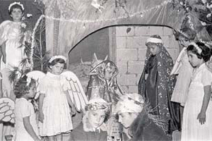
    On the school stage — Children in costume in a school performance. The album groups this photograph with school life in 1955–1965; individual names are not supplied.⤢ Tap to enlarge
    School theatre from the village archive; this is not a photograph of the memorial.
    Image creditΑρχείο kalamoti.net.gr · Μαρία & Αργυρώ Κανάριου
    The sculptor, before the monument

    Michail Tombros first encountered marble in his father’s workshop. The National Gallery records his later studies in Athens and Paris. Here, his work belongs to the village’s shared memory; the school beside it opens a different story, that of teacher Angeliki Damala.

    National Gallery · Michail Tombros

    Choose a visible detail or inscription. What would you ask about it?

    Source: Chios Travel Guide
    Meet the people behind shared works →
    Walk to the next stop
  3. Saint Konstantinos

    Pause by the church and look up at its bell tower. Continue through the public lanes, noticing how the buildings share a compact space. The walk does not depend on the church being open.

    Discover this stop
    LANDMARK PHOTOGRAPH
    Saint Konstantinos and Eleni, identified in the photograph’s original caption⤢ Tap to enlarge
    Saint Konstantinos and Eleni, identified in the photograph’s original caption
    Photograph & sourceGiannis Misetzis · Greece.com / Panoramio ↗

    Finding the stopMatch the narrow church front and the open bell tower directly above its entrance. The surrounding houses sit close to the façade.

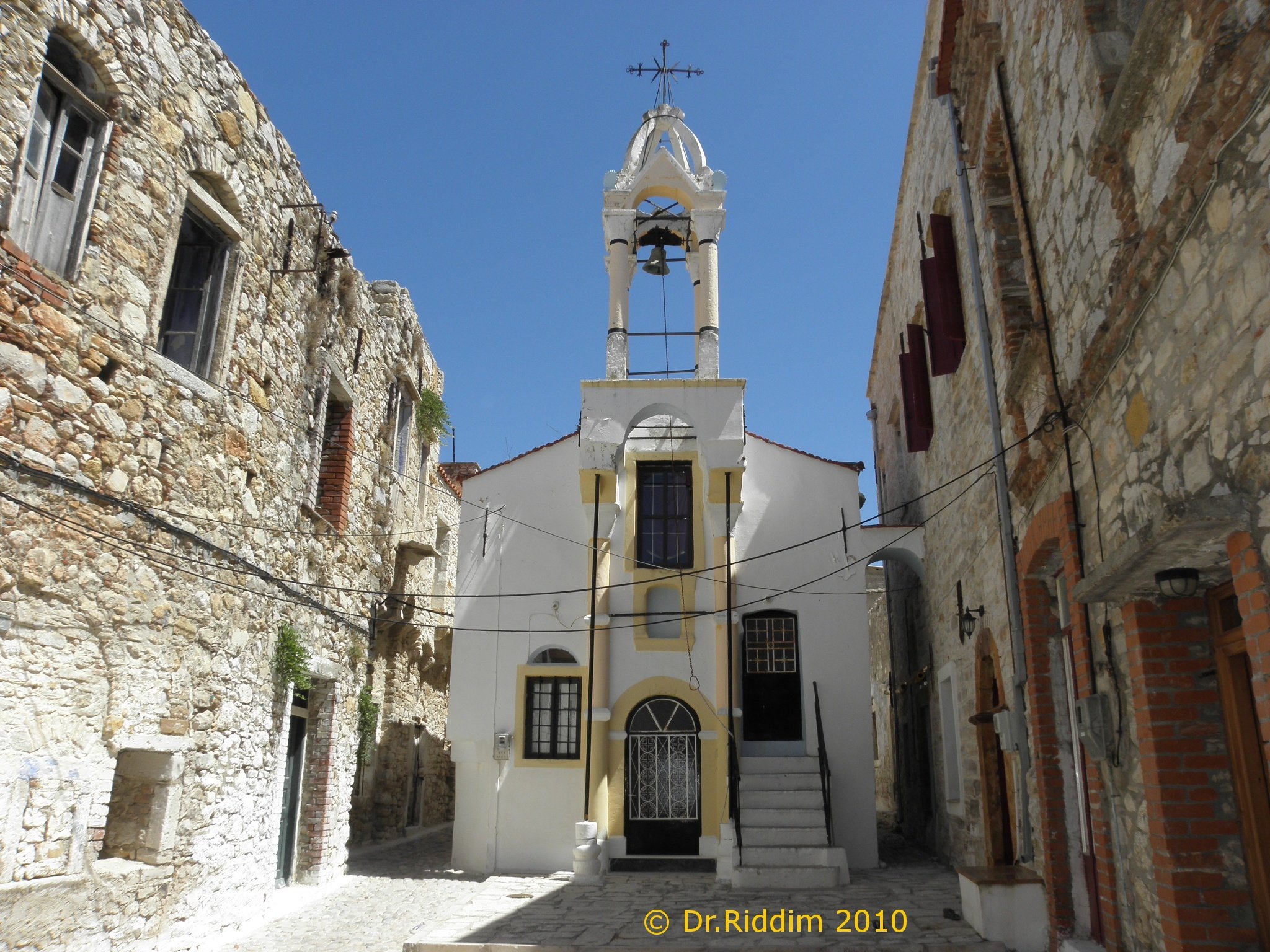
    ANOTHER LANDMARK VIEWA wider view of Saint Konstantinos: match the slender white bell tower, the arched lower doorway and the stairs on the right. The photographer dates this view to 2010.⤢ Tap to enlarge
    Approaching through the lane

    A wider view of Saint Konstantinos: match the slender white bell tower, the arched lower doorway and the stairs on the right. The photographer dates this view to 2010.

    Photograph & sourceDr.Riddim · Greece.com / Panoramio ↗
    THE STORY BEHIND THE PLACE

    A landmark above the lanes

    The Chios guide singles out Saint Konstantinos for its bell tower. Look at the tower from the lane, then at the neighbouring roofs. The changing view invites you to experience the church as part of the settlement, even when its doors are closed.

    A church and its neighbours

    The village archive includes Saint Konstantinos among the former parish churches. Parish life involved more than services: elected trustees arranged repairs, cared for furnishings and managed the resources needed for celebrations. The bell tower belonged to a neighbourhood sustained by that work.

    Village church archive

    Take a few steps along the public lane. What appears or disappears from view?

    Source: Chios Travel Guide
    Read the church’s visit guide →
    Walk to the next stop
  4. Kato Panagia · Presentation of the Virgin

    Kato Panagia is dedicated to the Presentation of the Virgin. View the church from outside and notice its place among the houses. Ask locally about entry if you would like to see the interior.

    Discover this stop
    LANDMARK PHOTOGRAPH
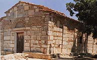
    Kato Panagia in the medieval village⤢ Tap to enlarge
    Kato Panagia in the medieval village
    Photograph & sourceGiannis Misetzis · Greece.com / Panoramio ↗

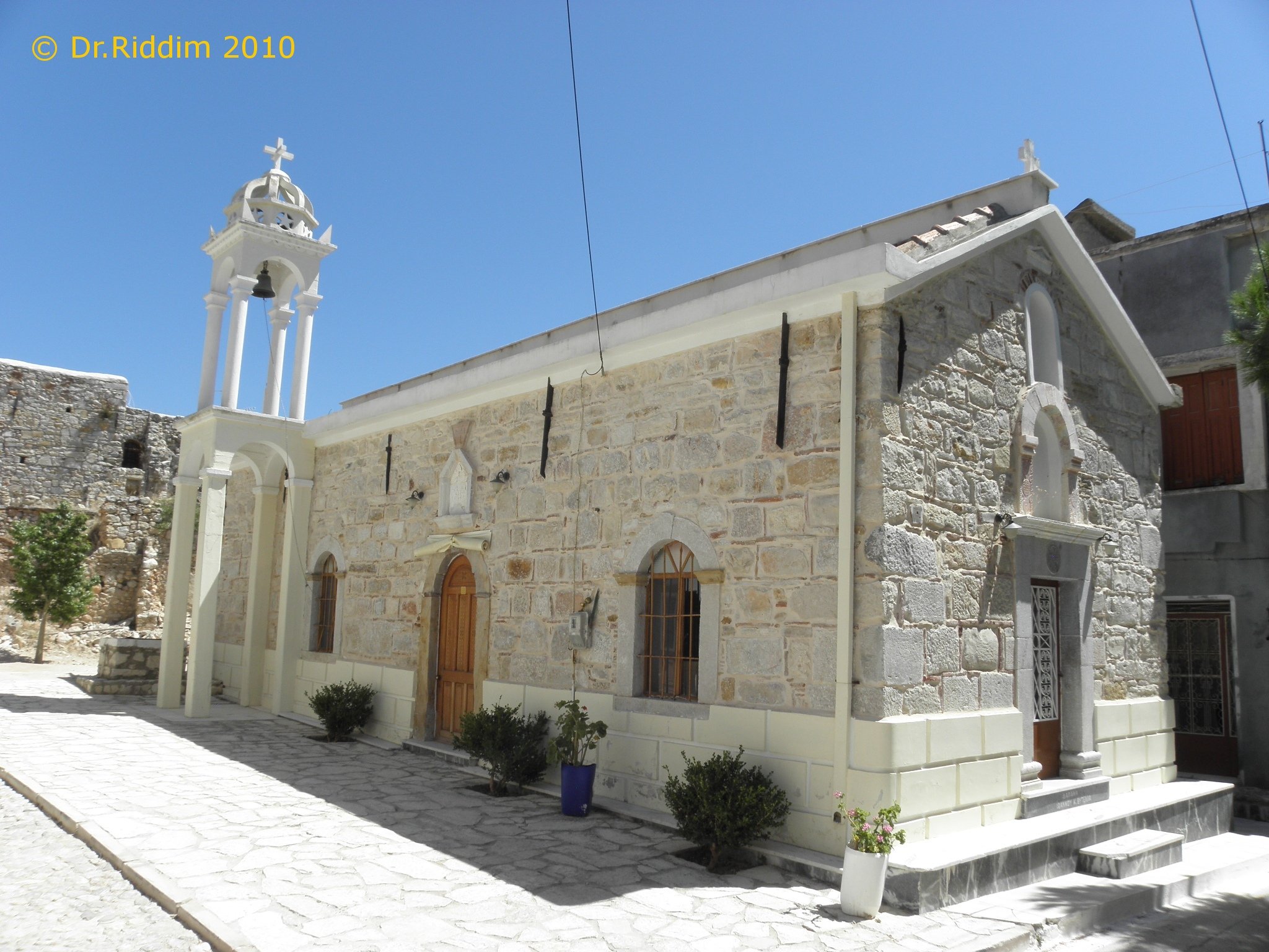
    Finding the stopLook for the long stone side wall, arched windows and the white bell tower at one end. This is Kato Panagia, dedicated to the Presentation, rather than Pano Panagia.

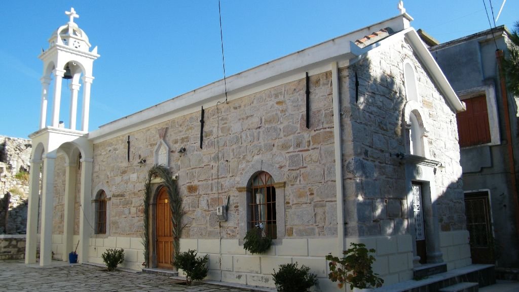
    ANOTHER LANDMARK VIEWKato Panagia from the side: notice the pale bell tower, arched windows and the different doorways along the stone wall. Photograph dated 2010.⤢ Tap to enlarge
    The long stone side wall

    Kato Panagia from the side: notice the pale bell tower, arched windows and the different doorways along the stone wall. Photograph dated 2010.

    Photograph & sourceDr.Riddim · Greece.com / Panoramio ↗
    THE STORY BEHIND THE PLACE

    The village beyond its stone walls

    Kato Panagia is dedicated to the Presentation of the Virgin; the Chios guide highlights its carved wooden iconostasis. The exterior gives you one part of the story. If entry is possible, the interior offers another way to look at craftsmanship and worship within the village.

    Woodwork behind the stone walls

    The iconostasis is a carved screen separating the sanctuary from the nave. If the church is open to visitors, give its wooden details the same attention as the stone outside. An exterior walk can still tell you how closely worship and domestic life shared the village’s lanes.

    Chios Travel Guide

    Notice how the church entrance meets the lane. Ask locally before planning an interior visit.

    Source: Chios Travel Guide
    Explore Kato Panagia →
    Walk back to the start
  5. Back at Platsa · finish

    Close the loop at the same place you started. Mark this final step only when you have returned.

    Discover this stop
    A VIEW OF LOCAL LIFE
    Inside the Platsa café, in a local account published in 2021; not an exterior arrival photograph⤢ Tap to enlarge
    Inside the Platsa café, in a local account published in 2021; not an exterior arrival photograph
    Photograph & sourceΜαστιχοχωρούσικα Νέα · Μιχάλης Κανάριος ↗

    Finding the stopBegin in the public space outside Platsa café. Confirm the café name and the map point before setting off; this indoor photograph cannot identify the entrance.

    A HISTORICAL SCENEA historical gathering at Monogyios’s café in Lower Platsa, identified in Michalis Kanarios’s 2021 account. This is a memory of café life, not today’s starting-point exterior.⤢ Tap to enlarge
    Café life in Lower Platsa

    A historical gathering at Monogyios’s café in Lower Platsa, identified in Michalis Kanarios’s 2021 account. This is a memory of café life, not today’s starting-point exterior.

    Photograph & sourceΜαστιχοχωρούσικα Νέα · Μιχάλης Κανάριος ↗
    THE STORY BEHIND THE PLACE

    The same square, a different view

    Before leaving Platsa, choose one detail you did not notice at the start. An arch, a doorway, a church or a memorial can become the beginning of your own village story. Give that discovery a little more time: read a resident’s account, or stay for a coffee in the village.

    What would you point out to someone visiting Kalamoti for the first time?

    Continue with the people’s stories →Stay for coffee or a meal →
    Kato Panagia → Platsa ↗
VILLAGE WALK 02

The little church loop

Leave Platsa towards the eastern lane, turn south towards Saint Konstantinos, continue west to Kato Panagia and return through the lanes to Platsa. The outward approach keeps the two churches in one circuit instead of an out-and-back walk.

≈ 550 m · Allow 30–45 minutes with pauses

Distance estimated by Google Maps on 3 November 2026. Suggested visit time includes pauses.
Open the complete loop in Google Maps ↗Directions to the start ↗
  1. Platsa café · meeting point

    Meet in the public space outside the café. Use its map pin as your starting reference, then look at how doorways and stone passages fit together around you. No purchase is needed to follow the walk.

    Discover this stop
    A VIEW OF LOCAL LIFE
    Inside the Platsa café, in a local account published in 2021; not an exterior arrival photograph⤢ Tap to enlarge
    Inside the Platsa café, in a local account published in 2021; not an exterior arrival photograph
    Photograph & sourceΜαστιχοχωρούσικα Νέα · Μιχάλης Κανάριος ↗

    Finding the stopBegin in the public space outside Platsa café. Confirm the café name and the map point before setting off; this indoor photograph cannot identify the entrance.

    A HISTORICAL SCENEA historical gathering at Monogyios’s café in Lower Platsa, identified in Michalis Kanarios’s 2021 account. This is a memory of café life, not today’s starting-point exterior.⤢ Tap to enlarge
    Café life in Lower Platsa

    A historical gathering at Monogyios’s café in Lower Platsa, identified in Michalis Kanarios’s 2021 account. This is a memory of café life, not today’s starting-point exterior.

    Photograph & sourceΜαστιχοχωρούσικα Νέα · Μιχάλης Κανάριος ↗
    THE STORY BEHIND THE PLACE

    A village built together

    In the older settlement, houses did more than shelter separate households. Their outer walls formed a defensive edge, while rooms and arches spanned the lanes. Look at the space above the street as well as the façades: the connection between buildings is part of Kalamoti’s story.

    Historic black-and-white photograph of stone arches in Kalamoti, dated 1930 by the Mingei catalogue⤢ Tap to enlarge
    Kalamoti arches, dated 1930 in the Mingei catalogue. A village archive view, not a photograph of the meeting point.
    Image creditMingei project / ICS-FORTH · via SearchCulture.gr · CC BY-SA 4.0
    The square after a day in the fields

    In his 2021 account, Michalis Kanarios remembers the cafés of the upper and lower Platsa in the 1950s–1970s. Men gathered after fieldwork to debate, exchange news and buy one another a drink. Read the square as a meeting place as well as a piece of medieval planning.

    Michalis Kanarios · The cafés of Kalamoti (2021)

    Follow one arch with your eyes. Which walls does it bring together?

    Source: Village architectural archive
    Explore the connected settlement →
    Walk to the next stop
  2. Saint Konstantinos

    Pause by the church and look up at its bell tower. Continue through the public lanes, noticing how the buildings share a compact space. The walk does not depend on the church being open.

    Discover this stop
    LANDMARK PHOTOGRAPH
    Saint Konstantinos and Eleni, identified in the photograph’s original caption⤢ Tap to enlarge
    Saint Konstantinos and Eleni, identified in the photograph’s original caption
    Photograph & sourceGiannis Misetzis · Greece.com / Panoramio ↗

    Finding the stopMatch the narrow church front and the open bell tower directly above its entrance. The surrounding houses sit close to the façade.

    ANOTHER LANDMARK VIEWA wider view of Saint Konstantinos: match the slender white bell tower, the arched lower doorway and the stairs on the right. The photographer dates this view to 2010.⤢ Tap to enlarge
    Approaching through the lane

    A wider view of Saint Konstantinos: match the slender white bell tower, the arched lower doorway and the stairs on the right. The photographer dates this view to 2010.

    Photograph & sourceDr.Riddim · Greece.com / Panoramio ↗
    THE STORY BEHIND THE PLACE

    A landmark above the lanes

    The Chios guide singles out Saint Konstantinos for its bell tower. Look at the tower from the lane, then at the neighbouring roofs. The changing view invites you to experience the church as part of the settlement, even when its doors are closed.

    A church and its neighbours

    The village archive includes Saint Konstantinos among the former parish churches. Parish life involved more than services: elected trustees arranged repairs, cared for furnishings and managed the resources needed for celebrations. The bell tower belonged to a neighbourhood sustained by that work.

    Village church archive

    Take a few steps along the public lane. What appears or disappears from view?

    Source: Chios Travel Guide
    Read the church’s visit guide →
    Walk to the next stop
  3. Kato Panagia · Presentation of the Virgin

    Kato Panagia is dedicated to the Presentation of the Virgin. View the church from outside and notice its place among the houses. Ask locally about entry if you would like to see the interior.

    Discover this stop
    LANDMARK PHOTOGRAPH
    Kato Panagia in the medieval village⤢ Tap to enlarge
    Kato Panagia in the medieval village
    Photograph & sourceGiannis Misetzis · Greece.com / Panoramio ↗

    Finding the stopLook for the long stone side wall, arched windows and the white bell tower at one end. This is Kato Panagia, dedicated to the Presentation, rather than Pano Panagia.

    ANOTHER LANDMARK VIEWKato Panagia from the side: notice the pale bell tower, arched windows and the different doorways along the stone wall. Photograph dated 2010.⤢ Tap to enlarge
    The long stone side wall

    Kato Panagia from the side: notice the pale bell tower, arched windows and the different doorways along the stone wall. Photograph dated 2010.

    Photograph & sourceDr.Riddim · Greece.com / Panoramio ↗
    THE STORY BEHIND THE PLACE

    The village beyond its stone walls

    Kato Panagia is dedicated to the Presentation of the Virgin; the Chios guide highlights its carved wooden iconostasis. The exterior gives you one part of the story. If entry is possible, the interior offers another way to look at craftsmanship and worship within the village.

    Woodwork behind the stone walls

    The iconostasis is a carved screen separating the sanctuary from the nave. If the church is open to visitors, give its wooden details the same attention as the stone outside. An exterior walk can still tell you how closely worship and domestic life shared the village’s lanes.

    Chios Travel Guide

    Notice how the church entrance meets the lane. Ask locally before planning an interior visit.

    Source: Chios Travel Guide
    Explore Kato Panagia →
    Walk back to the start
  4. Back at Platsa · finish

    Close the loop at the same place you started. Mark this final step only when you have returned.

    Discover this stop
    A VIEW OF LOCAL LIFE
    Inside the Platsa café, in a local account published in 2021; not an exterior arrival photograph⤢ Tap to enlarge
    Inside the Platsa café, in a local account published in 2021; not an exterior arrival photograph
    Photograph & sourceΜαστιχοχωρούσικα Νέα · Μιχάλης Κανάριος ↗

    Finding the stopBegin in the public space outside Platsa café. Confirm the café name and the map point before setting off; this indoor photograph cannot identify the entrance.

    A HISTORICAL SCENEA historical gathering at Monogyios’s café in Lower Platsa, identified in Michalis Kanarios’s 2021 account. This is a memory of café life, not today’s starting-point exterior.⤢ Tap to enlarge
    Café life in Lower Platsa

    A historical gathering at Monogyios’s café in Lower Platsa, identified in Michalis Kanarios’s 2021 account. This is a memory of café life, not today’s starting-point exterior.

    Photograph & sourceΜαστιχοχωρούσικα Νέα · Μιχάλης Κανάριος ↗
    THE STORY BEHIND THE PLACE

    The same square, a different view

    Before leaving Platsa, choose one detail you did not notice at the start. An arch, a doorway, a church or a memorial can become the beginning of your own village story. Give that discovery a little more time: read a resident’s account, or stay for a coffee in the village.

    What would you point out to someone visiting Kalamoti for the first time?

    Continue with the people’s stories →Stay for coffee or a meal →
    Kato Panagia → Platsa ↗
VILLAGE WALK 03

The countryside chapel loop

Leave Platsa for Kato Panagia, continue southwest to Panagia Agrelopousaina, then return by a different mapped approach to Saint Konstantinos and the village centre. A longer view of Kalamoti, connecting houses, fields and a Byzantine church. Short approach sections repeat.

≈ 3.3 km · Allow 1½–2 hours with pauses

Distance rounded from mapped streets, 3 November 2026. Visit time is a planning estimate including pauses.

Countryside outing: shared roads and rural tracks; not a waymarked trail. Carry water, allow daylight and check public access locally.

  1. Platsa café · meeting point

    Meet in the public space outside the café. Use its map pin as your starting reference, then look at how doorways and stone passages fit together around you. No purchase is needed to follow the walk.

    Discover this stop
    A VIEW OF LOCAL LIFE
    Inside the Platsa café, in a local account published in 2021; not an exterior arrival photograph⤢ Tap to enlarge
    Inside the Platsa café, in a local account published in 2021; not an exterior arrival photograph
    Photograph & sourceΜαστιχοχωρούσικα Νέα · Μιχάλης Κανάριος ↗

    Finding the stopBegin in the public space outside Platsa café. Confirm the café name and the map point before setting off; this indoor photograph cannot identify the entrance.

    A HISTORICAL SCENEA historical gathering at Monogyios’s café in Lower Platsa, identified in Michalis Kanarios’s 2021 account. This is a memory of café life, not today’s starting-point exterior.⤢ Tap to enlarge
    Café life in Lower Platsa

    A historical gathering at Monogyios’s café in Lower Platsa, identified in Michalis Kanarios’s 2021 account. This is a memory of café life, not today’s starting-point exterior.

    Photograph & sourceΜαστιχοχωρούσικα Νέα · Μιχάλης Κανάριος ↗
    THE STORY BEHIND THE PLACE

    A village built together

    In the older settlement, houses did more than shelter separate households. Their outer walls formed a defensive edge, while rooms and arches spanned the lanes. Look at the space above the street as well as the façades: the connection between buildings is part of Kalamoti’s story.

    Historic black-and-white photograph of stone arches in Kalamoti, dated 1930 by the Mingei catalogue⤢ Tap to enlarge
    Kalamoti arches, dated 1930 in the Mingei catalogue. A village archive view, not a photograph of the meeting point.
    Image creditMingei project / ICS-FORTH · via SearchCulture.gr · CC BY-SA 4.0
    The square after a day in the fields

    In his 2021 account, Michalis Kanarios remembers the cafés of the upper and lower Platsa in the 1950s–1970s. Men gathered after fieldwork to debate, exchange news and buy one another a drink. Read the square as a meeting place as well as a piece of medieval planning.

    Michalis Kanarios · The cafés of Kalamoti (2021)

    Follow one arch with your eyes. Which walls does it bring together?

    Source: Village architectural archive
    Explore the connected settlement →
    Walk to the next stop
  2. Kato Panagia · Presentation of the Virgin

    Kato Panagia is dedicated to the Presentation of the Virgin. View the church from outside and notice its place among the houses. Ask locally about entry if you would like to see the interior.

    Discover this stop
    LANDMARK PHOTOGRAPH
    Kato Panagia in the medieval village⤢ Tap to enlarge
    Kato Panagia in the medieval village
    Photograph & sourceGiannis Misetzis · Greece.com / Panoramio ↗

    Finding the stopLook for the long stone side wall, arched windows and the white bell tower at one end. This is Kato Panagia, dedicated to the Presentation, rather than Pano Panagia.

    ANOTHER LANDMARK VIEWKato Panagia from the side: notice the pale bell tower, arched windows and the different doorways along the stone wall. Photograph dated 2010.⤢ Tap to enlarge
    The long stone side wall

    Kato Panagia from the side: notice the pale bell tower, arched windows and the different doorways along the stone wall. Photograph dated 2010.

    Photograph & sourceDr.Riddim · Greece.com / Panoramio ↗
    THE STORY BEHIND THE PLACE

    The village beyond its stone walls

    Kato Panagia is dedicated to the Presentation of the Virgin; the Chios guide highlights its carved wooden iconostasis. The exterior gives you one part of the story. If entry is possible, the interior offers another way to look at craftsmanship and worship within the village.

    Woodwork behind the stone walls

    The iconostasis is a carved screen separating the sanctuary from the nave. If the church is open to visitors, give its wooden details the same attention as the stone outside. An exterior walk can still tell you how closely worship and domestic life shared the village’s lanes.

    Chios Travel Guide

    Notice how the church entrance meets the lane. Ask locally before planning an interior visit.

    Source: Chios Travel Guide
    Explore Kato Panagia →
    Walk to the next stop
  3. Panagia Agrelopousaina

    This countryside church is dedicated to the Dormition of the Virgin. Its masonry includes reused marble and its interior preserves Byzantine painting. The map pin is a reference: the final approach of about 40 m is not mapped as a footpath. Confirm access locally and view the church from an accessible public approach; an open interior is not promised.

    Discover this stop
    LANDMARK PHOTOGRAPH
    The stone entrance and brick arches along the side of Panagia Agrelopousaina near Kalamoti⤢ Tap to enlarge
    The stone entrance and brick arches along the side of Panagia Agrelopousaina near Kalamoti
    Photograph & sourceΑρχείο kalamoti.net.gr · Μαρία & Αργυρώ Κανάριου ↗

    Finding the stopOutside the village, look for the low tiled roof and shallow brick arches along the stone side wall. The archive view helps identify the building, not the condition of the approach.

    ANOTHER LANDMARK VIEWA wider view of Agrelopousaina, with its low roof, surrounding ground and tall tree. Published in a 2016 local history account; it shows the setting, not a verified present-day access path.⤢ Tap to enlarge
    The church in its countryside setting

    A wider view of Agrelopousaina, with its low roof, surrounding ground and tall tree. Published in a 2016 local history account; it shows the setting, not a verified present-day access path.

    Photograph & sourceΜαστιχοχωρούσικα Νέα ↗
    THE STORY BEHIND THE PLACE

    A countryside church with layers of time

    Away from the village lanes, Panagia Agrelopousaina brings stone, brick and reused marble into the same small building. Dedicated to the Dormition, it has a vaulted nave and a western narthex. Begin outside: compare the pale marble pieces with the masonry around them, then follow the brick arches along the side.

    Which pieces look as though they had a life before this wall? Look from an accessible public position without touching the fabric.

    Source: Olga Vassi · study of Agrelopousaina
    Explore the church and its architecture →
    Walk to the next stop
  4. Saint Konstantinos

    Pause by the church and look up at its bell tower. Continue through the public lanes, noticing how the buildings share a compact space. The walk does not depend on the church being open.

    Discover this stop
    LANDMARK PHOTOGRAPH
    Saint Konstantinos and Eleni, identified in the photograph’s original caption⤢ Tap to enlarge
    Saint Konstantinos and Eleni, identified in the photograph’s original caption
    Photograph & sourceGiannis Misetzis · Greece.com / Panoramio ↗

    Finding the stopMatch the narrow church front and the open bell tower directly above its entrance. The surrounding houses sit close to the façade.

    ANOTHER LANDMARK VIEWA wider view of Saint Konstantinos: match the slender white bell tower, the arched lower doorway and the stairs on the right. The photographer dates this view to 2010.⤢ Tap to enlarge
    Approaching through the lane

    A wider view of Saint Konstantinos: match the slender white bell tower, the arched lower doorway and the stairs on the right. The photographer dates this view to 2010.

    Photograph & sourceDr.Riddim · Greece.com / Panoramio ↗
    THE STORY BEHIND THE PLACE

    A landmark above the lanes

    The Chios guide singles out Saint Konstantinos for its bell tower. Look at the tower from the lane, then at the neighbouring roofs. The changing view invites you to experience the church as part of the settlement, even when its doors are closed.

    A church and its neighbours

    The village archive includes Saint Konstantinos among the former parish churches. Parish life involved more than services: elected trustees arranged repairs, cared for furnishings and managed the resources needed for celebrations. The bell tower belonged to a neighbourhood sustained by that work.

    Village church archive

    Take a few steps along the public lane. What appears or disappears from view?

    Source: Chios Travel Guide
    Read the church’s visit guide →
    Walk back to the start
  5. Back at Platsa · finish

    Close the loop at the same place you started. Mark this final step only when you have returned.

    Discover this stop
    A VIEW OF LOCAL LIFE
    Inside the Platsa café, in a local account published in 2021; not an exterior arrival photograph⤢ Tap to enlarge
    Inside the Platsa café, in a local account published in 2021; not an exterior arrival photograph
    Photograph & sourceΜαστιχοχωρούσικα Νέα · Μιχάλης Κανάριος ↗

    Finding the stopBegin in the public space outside Platsa café. Confirm the café name and the map point before setting off; this indoor photograph cannot identify the entrance.

    A HISTORICAL SCENEA historical gathering at Monogyios’s café in Lower Platsa, identified in Michalis Kanarios’s 2021 account. This is a memory of café life, not today’s starting-point exterior.⤢ Tap to enlarge
    Café life in Lower Platsa

    A historical gathering at Monogyios’s café in Lower Platsa, identified in Michalis Kanarios’s 2021 account. This is a memory of café life, not today’s starting-point exterior.

    Photograph & sourceΜαστιχοχωρούσικα Νέα · Μιχάλης Κανάριος ↗
    THE STORY BEHIND THE PLACE

    The same square, a different view

    Before leaving Platsa, choose one detail you did not notice at the start. An arch, a doorway, a church or a memorial can become the beginning of your own village story. Give that discovery a little more time: read a resident’s account, or stay for a coffee in the village.

    What would you point out to someone visiting Kalamoti for the first time?

    Continue with the people’s stories →Stay for coffee or a meal →
    Saint Konstantinos → Platsa ↗
VILLAGE WALK 04

Kalamoti & Patrika loop

Start in Platsa, pause by the school and Tombros memorial, and head east to Patrika. A southern return through mapped rural roads brings you back to Saint Konstantinos and Kato Panagia before closing the loop. Compare two living villages and the cultivated landscape between them.

≈ 4.4 km · Allow 2–2½ hours with pauses

Distance rounded from mapped streets, 3 November 2026. Visit time is a planning estimate including pauses.

Countryside outing: shared roads and rural tracks; not a waymarked trail. Carry water, allow daylight and check public access locally.

  1. Platsa café · meeting point

    Meet in the public space outside the café. Use its map pin as your starting reference, then look at how doorways and stone passages fit together around you. No purchase is needed to follow the walk.

    Discover this stop
    A VIEW OF LOCAL LIFE
    Inside the Platsa café, in a local account published in 2021; not an exterior arrival photograph⤢ Tap to enlarge
    Inside the Platsa café, in a local account published in 2021; not an exterior arrival photograph
    Photograph & sourceΜαστιχοχωρούσικα Νέα · Μιχάλης Κανάριος ↗

    Finding the stopBegin in the public space outside Platsa café. Confirm the café name and the map point before setting off; this indoor photograph cannot identify the entrance.

    A HISTORICAL SCENEA historical gathering at Monogyios’s café in Lower Platsa, identified in Michalis Kanarios’s 2021 account. This is a memory of café life, not today’s starting-point exterior.⤢ Tap to enlarge
    Café life in Lower Platsa

    A historical gathering at Monogyios’s café in Lower Platsa, identified in Michalis Kanarios’s 2021 account. This is a memory of café life, not today’s starting-point exterior.

    Photograph & sourceΜαστιχοχωρούσικα Νέα · Μιχάλης Κανάριος ↗
    THE STORY BEHIND THE PLACE

    A village built together

    In the older settlement, houses did more than shelter separate households. Their outer walls formed a defensive edge, while rooms and arches spanned the lanes. Look at the space above the street as well as the façades: the connection between buildings is part of Kalamoti’s story.

    Historic black-and-white photograph of stone arches in Kalamoti, dated 1930 by the Mingei catalogue⤢ Tap to enlarge
    Kalamoti arches, dated 1930 in the Mingei catalogue. A village archive view, not a photograph of the meeting point.
    Image creditMingei project / ICS-FORTH · via SearchCulture.gr · CC BY-SA 4.0
    The square after a day in the fields

    In his 2021 account, Michalis Kanarios remembers the cafés of the upper and lower Platsa in the 1950s–1970s. Men gathered after fieldwork to debate, exchange news and buy one another a drink. Read the square as a meeting place as well as a piece of medieval planning.

    Michalis Kanarios · The cafés of Kalamoti (2021)

    Follow one arch with your eyes. Which walls does it bring together?

    Source: Village architectural archive
    Explore the connected settlement →
    Walk to the next stop
  2. Tombros memorial · beside the school

    The marble memorial by Michail Tombros stands beside the primary school. The map pin marks the school as a nearby reference, not the sculpture itself. Look from the public space without entering the school grounds.

    Discover this stop
    LANDMARK PHOTOGRAPH
    Michail Tombros’s marble relief beside the primary school⤢ Tap to enlarge
    Michail Tombros’s marble relief beside the primary school
    Photograph & sourceΜαστιχοχωρούσικα Νέα ↗

    Finding the stopLook for the upright white marble relief and its carved figure beside the primary school. The school pin is a nearby reference; stay in the public space.

    THE SURROUNDINGSThe primary school’s stone façade and entrance steps help place the memorial in its surroundings. View from the public road; the school grounds are not part of the walk. Published in 2016.⤢ Tap to enlarge
    The school beside the memorial

    The primary school’s stone façade and entrance steps help place the memorial in its surroundings. View from the public road; the school grounds are not part of the walk. Published in 2016.

    Photograph & sourceΜαστιχοχωρούσικα Νέα ↗
    THE STORY BEHIND THE PLACE

    A place for shared memory

    The marble relief beside the primary school is a work by sculptor Michail Tombros. Let it widen your view of Kalamoti beyond its medieval houses: public art and shared places also shape how a village remembers.

    On the school stage — Children in costume in a school performance. The album groups this photograph with school life in 1955–1965; individual names are not supplied.⤢ Tap to enlarge
    School theatre from the village archive; this is not a photograph of the memorial.
    Image creditΑρχείο kalamoti.net.gr · Μαρία & Αργυρώ Κανάριου
    The sculptor, before the monument

    Michail Tombros first encountered marble in his father’s workshop. The National Gallery records his later studies in Athens and Paris. Here, his work belongs to the village’s shared memory; the school beside it opens a different story, that of teacher Angeliki Damala.

    National Gallery · Michail Tombros

    Choose a visible detail or inscription. What would you ask about it?

    Source: Chios Travel Guide
    Meet the people behind shared works →
    Walk to the next stop
  3. Patrika · village lanes

    Pause in Kalamoti’s neighbouring mastic village. Compare the close-set houses and narrow passages with those you have just left. The pin marks the mapped village centre, not a specific church entrance. Explore public lanes and leave private courtyards undisturbed.

    Discover this stop
    A VIEW OF LOCAL LIFE
    Patrika, from the local village guide; a village view rather than an exact meeting-point photograph⤢ Tap to enlarge
    Patrika, from the local village guide; a village view rather than an exact meeting-point photograph
    Photograph & sourcePatrika Village ↗

    Finding the stopUse the mapped village centre as the stop. This photograph shows a covered stone lane in Patrika, not the exact arrival point; stay on public passages when exploring.

    THE SURROUNDINGSA narrow lane in Patrika from the island tourism guide. Compare the stone walls and closely spaced entrances with Kalamoti. This is a village view, not the exact mapped arrival point.⤢ Tap to enlarge
    Another lane to explore

    A narrow lane in Patrika from the island tourism guide. Compare the stone walls and closely spaced entrances with Kalamoti. This is a village view, not the exact mapped arrival point.

    Photograph & sourceDiscover Chios ↗
    THE STORY BEHIND THE PLACE

    A neighbouring village remembers its beginnings

    The local Patrika guide preserves an account passed down by older residents, including lessons attributed to teacher Nikolaos Brilis. It connects the village’s name with families returning to their ancestral places, while acknowledging that early dates lack documentary proof. Treat it as local memory. In the lanes, compare the covered passages and closely joined houses with those you left in Kalamoti.

    Choose one doorway or arch to compare with Kalamoti when you return. Do the houses meet the lane in the same way?

    Source: Patrika Village · local account
    Plan your pause in Patrika →
    Walk to the next stop
  4. Saint Konstantinos

    Pause by the church and look up at its bell tower. Continue through the public lanes, noticing how the buildings share a compact space. The walk does not depend on the church being open.

    Discover this stop
    LANDMARK PHOTOGRAPH
    Saint Konstantinos and Eleni, identified in the photograph’s original caption⤢ Tap to enlarge
    Saint Konstantinos and Eleni, identified in the photograph’s original caption
    Photograph & sourceGiannis Misetzis · Greece.com / Panoramio ↗

    Finding the stopMatch the narrow church front and the open bell tower directly above its entrance. The surrounding houses sit close to the façade.

    ANOTHER LANDMARK VIEWA wider view of Saint Konstantinos: match the slender white bell tower, the arched lower doorway and the stairs on the right. The photographer dates this view to 2010.⤢ Tap to enlarge
    Approaching through the lane

    A wider view of Saint Konstantinos: match the slender white bell tower, the arched lower doorway and the stairs on the right. The photographer dates this view to 2010.

    Photograph & sourceDr.Riddim · Greece.com / Panoramio ↗
    THE STORY BEHIND THE PLACE

    A landmark above the lanes

    The Chios guide singles out Saint Konstantinos for its bell tower. Look at the tower from the lane, then at the neighbouring roofs. The changing view invites you to experience the church as part of the settlement, even when its doors are closed.

    A church and its neighbours

    The village archive includes Saint Konstantinos among the former parish churches. Parish life involved more than services: elected trustees arranged repairs, cared for furnishings and managed the resources needed for celebrations. The bell tower belonged to a neighbourhood sustained by that work.

    Village church archive

    Take a few steps along the public lane. What appears or disappears from view?

    Source: Chios Travel Guide
    Read the church’s visit guide →
    Walk to the next stop
  5. Kato Panagia · Presentation of the Virgin

    Kato Panagia is dedicated to the Presentation of the Virgin. View the church from outside and notice its place among the houses. Ask locally about entry if you would like to see the interior.

    Discover this stop
    LANDMARK PHOTOGRAPH
    Kato Panagia in the medieval village⤢ Tap to enlarge
    Kato Panagia in the medieval village
    Photograph & sourceGiannis Misetzis · Greece.com / Panoramio ↗

    Finding the stopLook for the long stone side wall, arched windows and the white bell tower at one end. This is Kato Panagia, dedicated to the Presentation, rather than Pano Panagia.

    ANOTHER LANDMARK VIEWKato Panagia from the side: notice the pale bell tower, arched windows and the different doorways along the stone wall. Photograph dated 2010.⤢ Tap to enlarge
    The long stone side wall

    Kato Panagia from the side: notice the pale bell tower, arched windows and the different doorways along the stone wall. Photograph dated 2010.

    Photograph & sourceDr.Riddim · Greece.com / Panoramio ↗
    THE STORY BEHIND THE PLACE

    The village beyond its stone walls

    Kato Panagia is dedicated to the Presentation of the Virgin; the Chios guide highlights its carved wooden iconostasis. The exterior gives you one part of the story. If entry is possible, the interior offers another way to look at craftsmanship and worship within the village.

    Woodwork behind the stone walls

    The iconostasis is a carved screen separating the sanctuary from the nave. If the church is open to visitors, give its wooden details the same attention as the stone outside. An exterior walk can still tell you how closely worship and domestic life shared the village’s lanes.

    Chios Travel Guide

    Notice how the church entrance meets the lane. Ask locally before planning an interior visit.

    Source: Chios Travel Guide
    Explore Kato Panagia →
    Walk back to the start
  6. Back at Platsa · finish

    Close the loop at the same place you started. Mark this final step only when you have returned.

    Discover this stop
    A VIEW OF LOCAL LIFE
    Inside the Platsa café, in a local account published in 2021; not an exterior arrival photograph⤢ Tap to enlarge
    Inside the Platsa café, in a local account published in 2021; not an exterior arrival photograph
    Photograph & sourceΜαστιχοχωρούσικα Νέα · Μιχάλης Κανάριος ↗

    Finding the stopBegin in the public space outside Platsa café. Confirm the café name and the map point before setting off; this indoor photograph cannot identify the entrance.

    A HISTORICAL SCENEA historical gathering at Monogyios’s café in Lower Platsa, identified in Michalis Kanarios’s 2021 account. This is a memory of café life, not today’s starting-point exterior.⤢ Tap to enlarge
    Café life in Lower Platsa

    A historical gathering at Monogyios’s café in Lower Platsa, identified in Michalis Kanarios’s 2021 account. This is a memory of café life, not today’s starting-point exterior.

    Photograph & sourceΜαστιχοχωρούσικα Νέα · Μιχάλης Κανάριος ↗
    THE STORY BEHIND THE PLACE

    The same square, a different view

    Before leaving Platsa, choose one detail you did not notice at the start. An arch, a doorway, a church or a memorial can become the beginning of your own village story. Give that discovery a little more time: read a resident’s account, or stay for a coffee in the village.

    What would you point out to someone visiting Kalamoti for the first time?

    Continue with the people’s stories →Stay for coffee or a meal →
    Kato Panagia → Platsa ↗
VILLAGE WALK 05

Five churches · the village circuit

Start and finish outside Platsa café in the centre. Visit Pano Panagia, Kato Panagia, Saint Konstantinos, Agia Kyriaki and Agia Paraskevi in that order. The 970 m street loop visits each church once without repeating a mapped street section. Short entrance approaches are additional; follow the numbered map and confirm public access locally.

≈ 970 m · Allow 60–90 minutes with pauses

Distance rounded from mapped streets, 3 November 2026. Visit time is a planning estimate including pauses.
  1. Platsa café · meeting point

    Meet in the public space outside the café. Use its map pin as your starting reference, then look at how doorways and stone passages fit together around you. No purchase is needed to follow the walk.

    Discover this stop
    A VIEW OF LOCAL LIFE
    Inside the Platsa café, in a local account published in 2021; not an exterior arrival photograph⤢ Tap to enlarge
    Inside the Platsa café, in a local account published in 2021; not an exterior arrival photograph
    Photograph & sourceΜαστιχοχωρούσικα Νέα · Μιχάλης Κανάριος ↗

    Finding the stopBegin in the public space outside Platsa café. Confirm the café name and the map point before setting off; this indoor photograph cannot identify the entrance.

    A HISTORICAL SCENEA historical gathering at Monogyios’s café in Lower Platsa, identified in Michalis Kanarios’s 2021 account. This is a memory of café life, not today’s starting-point exterior.⤢ Tap to enlarge
    Café life in Lower Platsa

    A historical gathering at Monogyios’s café in Lower Platsa, identified in Michalis Kanarios’s 2021 account. This is a memory of café life, not today’s starting-point exterior.

    Photograph & sourceΜαστιχοχωρούσικα Νέα · Μιχάλης Κανάριος ↗
    THE STORY BEHIND THE PLACE

    A village built together

    In the older settlement, houses did more than shelter separate households. Their outer walls formed a defensive edge, while rooms and arches spanned the lanes. Look at the space above the street as well as the façades: the connection between buildings is part of Kalamoti’s story.

    Historic black-and-white photograph of stone arches in Kalamoti, dated 1930 by the Mingei catalogue⤢ Tap to enlarge
    Kalamoti arches, dated 1930 in the Mingei catalogue. A village archive view, not a photograph of the meeting point.
    Image creditMingei project / ICS-FORTH · via SearchCulture.gr · CC BY-SA 4.0
    The square after a day in the fields

    In his 2021 account, Michalis Kanarios remembers the cafés of the upper and lower Platsa in the 1950s–1970s. Men gathered after fieldwork to debate, exchange news and buy one another a drink. Read the square as a meeting place as well as a piece of medieval planning.

    Michalis Kanarios · The cafés of Kalamoti (2021)

    Follow one arch with your eyes. Which walls does it bring together?

    Source: Village architectural archive
    Explore the connected settlement →
    Walk to the next stop
  2. Pano Panagia · Dormition

    Begin with Pano Panagia, dedicated to the Dormition of the Virgin. Later in this loop you will meet Kato Panagia, whose dedication is different. Notice how this church sits within the compact village fabric.

    Discover this stop
    LANDMARK PHOTOGRAPH
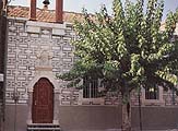
    Pano Panagia, with a tree in front of its arched doorways⤢ Tap to enlarge
    Pano Panagia, with a tree in front of its arched doorways
    Photograph & sourceΑρχείο kalamoti.net.gr · Μαρία & Αργυρώ Κανάριου ↗

    Finding the stopCompare the arched doorways with this small archive view. Confirm Pano Panagia—the Dormition church—by name; planting and paintwork may have changed.

    ANOTHER LANDMARK VIEWPano Panagia, identified as the Dormition church in the original caption. Compare the small open bell arch, the tree and the patterned façade with the older archive view; surface finishes change over time.⤢ Tap to enlarge
    The bell above the doorway

    Pano Panagia, identified as the Dormition church in the original caption. Compare the small open bell arch, the tree and the patterned façade with the older archive view; surface finishes change over time.

    Photograph & sourceGiannis Misetzis · Greece.com / Panoramio ↗
    THE STORY BEHIND THE PLACE

    Two churches, two dedications

    The village archive records Pano Panagia among Kalamoti’s former parish churches and identifies its dedication as the Dormition. Kato Panagia, later on this circuit, is dedicated to the Presentation of the Virgin. Knowing the names helps you keep the two places and their stories distinct.

    Names that keep places distinct

    The village had several parish communities before their churches became chapels of Agia Paraskevi. Pano Panagia’s dedication to the Dormition is a useful way to distinguish it from Kato Panagia. Keep both names in mind when asking a resident for directions.

    Village church archive

    Remember one detail of the entrance to compare with Kato Panagia later.

    Source: Village church archive
    Explore Pano Panagia →
    Walk to the next stop
  3. Kato Panagia · Presentation of the Virgin

    Kato Panagia is dedicated to the Presentation of the Virgin. View the church from outside and notice its place among the houses. Ask locally about entry if you would like to see the interior.

    Discover this stop
    LANDMARK PHOTOGRAPH
    Kato Panagia in the medieval village⤢ Tap to enlarge
    Kato Panagia in the medieval village
    Photograph & sourceGiannis Misetzis · Greece.com / Panoramio ↗

    Finding the stopLook for the long stone side wall, arched windows and the white bell tower at one end. This is Kato Panagia, dedicated to the Presentation, rather than Pano Panagia.

    ANOTHER LANDMARK VIEWKato Panagia from the side: notice the pale bell tower, arched windows and the different doorways along the stone wall. Photograph dated 2010.⤢ Tap to enlarge
    The long stone side wall

    Kato Panagia from the side: notice the pale bell tower, arched windows and the different doorways along the stone wall. Photograph dated 2010.

    Photograph & sourceDr.Riddim · Greece.com / Panoramio ↗
    THE STORY BEHIND THE PLACE

    The village beyond its stone walls

    Kato Panagia is dedicated to the Presentation of the Virgin; the Chios guide highlights its carved wooden iconostasis. The exterior gives you one part of the story. If entry is possible, the interior offers another way to look at craftsmanship and worship within the village.

    Woodwork behind the stone walls

    The iconostasis is a carved screen separating the sanctuary from the nave. If the church is open to visitors, give its wooden details the same attention as the stone outside. An exterior walk can still tell you how closely worship and domestic life shared the village’s lanes.

    Chios Travel Guide

    Notice how the church entrance meets the lane. Ask locally before planning an interior visit.

    Source: Chios Travel Guide
    Explore Kato Panagia →
    Walk to the next stop
  4. Saint Konstantinos

    Pause by the church and look up at its bell tower. Continue through the public lanes, noticing how the buildings share a compact space. The walk does not depend on the church being open.

    Discover this stop
    LANDMARK PHOTOGRAPH
    Saint Konstantinos and Eleni, identified in the photograph’s original caption⤢ Tap to enlarge
    Saint Konstantinos and Eleni, identified in the photograph’s original caption
    Photograph & sourceGiannis Misetzis · Greece.com / Panoramio ↗

    Finding the stopMatch the narrow church front and the open bell tower directly above its entrance. The surrounding houses sit close to the façade.

    ANOTHER LANDMARK VIEWA wider view of Saint Konstantinos: match the slender white bell tower, the arched lower doorway and the stairs on the right. The photographer dates this view to 2010.⤢ Tap to enlarge
    Approaching through the lane

    A wider view of Saint Konstantinos: match the slender white bell tower, the arched lower doorway and the stairs on the right. The photographer dates this view to 2010.

    Photograph & sourceDr.Riddim · Greece.com / Panoramio ↗
    THE STORY BEHIND THE PLACE

    A landmark above the lanes

    The Chios guide singles out Saint Konstantinos for its bell tower. Look at the tower from the lane, then at the neighbouring roofs. The changing view invites you to experience the church as part of the settlement, even when its doors are closed.

    A church and its neighbours

    The village archive includes Saint Konstantinos among the former parish churches. Parish life involved more than services: elected trustees arranged repairs, cared for furnishings and managed the resources needed for celebrations. The bell tower belonged to a neighbourhood sustained by that work.

    Village church archive

    Take a few steps along the public lane. What appears or disappears from view?

    Source: Chios Travel Guide
    Read the church’s visit guide →
    Walk to the next stop
  5. Agia Kyriaki

    This church connects the walk with Kalamoti’s July religious celebrations. Pause outside and read its story, then follow the western return towards Agia Paraskevi. Services take priority over sightseeing.

    Discover this stop
    LANDMARK PHOTOGRAPH
    Agia Kyriaki, with its bell tower above the lane⤢ Tap to enlarge
    Agia Kyriaki, with its bell tower above the lane
    Photograph & sourceΑρχείο kalamoti.net.gr · Μαρία & Αργυρώ Κανάριου ↗

    Finding the stopLook upwards from the lane for the bell tower shown in the village archive. Use the map and the church name together; several village churches have bell towers.

    ANOTHER LANDMARK VIEWAgia Kyriaki seen from below, with its bell tower on the corner and tall arched side windows. Compare the tower with the wider archive façade before continuing.⤢ Tap to enlarge
    The tower from the corner

    Agia Kyriaki seen from below, with its bell tower on the corner and tall arched side windows. Compare the tower with the wider archive façade before continuing.

    Photograph & sourceskonix · Greece.com / Panoramio ↗
    THE STORY BEHIND THE PLACE

    The care behind a church

    Agia Kyriaki appears among the former parish churches in the village archive. The same account describes the work of parish trustees: caring for buildings and furnishings, managing resources and organising celebrations. A church’s story includes that everyday shared responsibility as well as its architecture.

    The people who kept the lamps lit

    The archive describes trustees looking after stalls, lamps, candlesticks and icons, as well as organising repairs and keeping accounts. These were practical responsibilities shared within parish life. As you pause here, imagine the preparation behind an open door on a feast day.

    Village church archive

    What work would be needed to keep a place like this ready for a celebration?

    Source: Village church archive
    Explore Agia Kyriaki →
    Walk to the next stop
  6. Agia Paraskevi

    A final church stop close to the centre. Pause outside, then follow the short return to Platsa. The feast day belongs to the village’s religious calendar; access today depends on local arrangements.

    Discover this stop
    LANDMARK PHOTOGRAPH
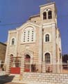
    Agia Paraskevi parish church⤢ Tap to enlarge
    Agia Paraskevi parish church
    Photograph & sourceΙερά Μητρόπολη Χίου ↗

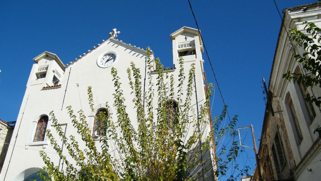
    Finding the stopThe parish photograph shows a broad façade with a central clock and two bell towers. Look at the paved space in front as well as the church.

    ANOTHER LANDMARK VIEWA second view of Agia Paraskevi’s upper façade. The central clock and the two square bell towers help distinguish it from the other churches on the walk.⤢ Tap to enlarge
    Look for the clock and twin towers

    A second view of Agia Paraskevi’s upper façade. The central clock and the two square bell towers help distinguish it from the other churches on the walk.

    Photograph & sourceGiannis Misetzis · Greece.com / Panoramio ↗
    THE STORY BEHIND THE PLACE

    A church at the centre of community life

    The local archive identifies Agia Paraskevi as the village church from 1681. That date describes its community role; it does not date every wall you see today. End the church circuit with this distinction in mind: a place’s long history includes changing buildings and continuing relationships.

    Look back towards the lanes before returning to Platsa. How does the church connect with the neighbourhood?

    Source: Village church archive
    Explore Agia Paraskevi →
    Walk back to the start
  7. Back at Platsa · finish

    Close the loop at the same place you started. Mark this final step only when you have returned.

    Discover this stop
    A VIEW OF LOCAL LIFE
    Inside the Platsa café, in a local account published in 2021; not an exterior arrival photograph⤢ Tap to enlarge
    Inside the Platsa café, in a local account published in 2021; not an exterior arrival photograph
    Photograph & sourceΜαστιχοχωρούσικα Νέα · Μιχάλης Κανάριος ↗

    Finding the stopBegin in the public space outside Platsa café. Confirm the café name and the map point before setting off; this indoor photograph cannot identify the entrance.

    A HISTORICAL SCENEA historical gathering at Monogyios’s café in Lower Platsa, identified in Michalis Kanarios’s 2021 account. This is a memory of café life, not today’s starting-point exterior.⤢ Tap to enlarge
    Café life in Lower Platsa

    A historical gathering at Monogyios’s café in Lower Platsa, identified in Michalis Kanarios’s 2021 account. This is a memory of café life, not today’s starting-point exterior.

    Photograph & sourceΜαστιχοχωρούσικα Νέα · Μιχάλης Κανάριος ↗
    THE STORY BEHIND THE PLACE

    The same square, a different view

    Before leaving Platsa, choose one detail you did not notice at the start. An arch, a doorway, a church or a memorial can become the beginning of your own village story. Give that discovery a little more time: read a resident’s account, or stay for a coffee in the village.

    What would you point out to someone visiting Kalamoti for the first time?

    Continue with the people’s stories →Stay for coffee or a meal →
    Agia Paraskevi → Platsa ↗

Map points & sources

Reference pins checked against Google Maps and OpenStreetMap on 3 November 2026. The start uses Platsa café’s pin; the memorial uses the neighbouring school’s pin. These identify landmarks, not guaranteed accessible entrances.
Patrika · OpenStreetMap · Panagia Agrelopousaina · Olga Vassi · Chios Tourism · Kalamoti · Village archive · architecture · Village archive · churches

After the walk: coffee & food ↗
YOUR KALAMOTI, TOO

A place lives through the stories we share.

A walk you loved, a family memory, a photograph worth keeping. Send your experience to help others discover the village through your eyes.

Share a story or photo →

Your saved places

Put your stops in the order you want to visit. Copy the list or download it to keep the names and links with you.

Saved in this browser. The downloaded text file works offline; opening guide pages and maps needs a connection.

KALAMOTI.GR

Find your way.

KALAMOTI · READING ROOM

A short presentation by the Kalamoti guide, based on the cited sources.

Stay here to read; close this window to continue where you left off.